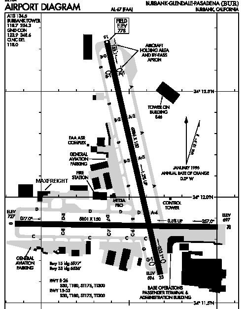
- ICAO code: KBUR
- Location: Bob Hope Airport,
Burbank, California, United States
- Latitude: 34* 12' 2.400"
N
- Longitude: 118* 21' 31.200"
W
- Elevation: 778 ft.
- Runways:
- Runway 15/33 - heading 152*/332*
- 6,886 x 150 ft.
- Runway 8/26 - heading 76*/256*
- 5,801 x 150 ft.
- ILS rwy 8 - IBUR - 109.50
- For real world details, visit


Click on the picture above for an airport
diagram of KBUR.
To monitor the real world Burbank air traffic click below.

|